Guides
Language
EnglishCurrency
US dollar · $GetYourGuide shows prices in the currency you choose.
Guide · Views
Can you see Mount Fuji from Tokyo? Where and when
On a clear day the mountain rises over the western edge of the city, about 101 km away. Here is where to stand, which months give the best odds, and what to do when it hides.
Editorial team, mount-fuji-tour.comUpdated October 22, 20266 minutes to read49 sources
Quick answer
Yes, but only on the right day
Can you see Mount Fuji from Tokyo? Yes. Japan's national tourism organization notes that the mountain is visible to residents of distant Tokyo, and the city's observation decks advertise the view.12 The summit stands about 101 km from Tokyo Station in a straight line, far enough that haze, cloud or a grey sky can erase it completely.7
That distance is the whole story. From a skyscraper in Shinjuku you are looking across about 95 km of air towards the west-southwest.8 On a dry winter morning the cone stands out sharp and white; on a humid summer afternoon you may not even see the hills in front of it. Air pollution plays a smaller part than moisture: it is the water in the air, and the cloud that forms around a tall mountain during the day, that decides whether the view is there.
The honest answer, then, is yes: often in winter and rarely in the rainy months. Plan a viewpoint for your first clear morning rather than for a fixed date, and keep a backup idea for the day the horizon stays white. A view from the city is a lovely extra, but it is not a reason to change a whole itinerary; a day at the lakes is.
The free view from the Shinjuku city hall
The easiest Mount Fuji view from Tokyo costs nothing. The Tokyo Metropolitan Government building in Shinjuku has two towers, each with an observatory on the 45th floor, 202 m above the ground, and on a clear day Fuji can be seen well from them.2 The observatories are completely free of charge.2
Head for the windows that face west and south-west, towards the hills on the edge of the city. Fuji appears as a pale cone beyond the nearer mountains, smaller than most people expect at this distance, and clearest early in the day.
Shinjuku is also where many Fuji tours and the direct train to the lakes start. If you are booked on a tour meeting there at 8:30 AM, an earlier visit to the deck the evening before lets you check the sky for the next day. Expect queues for the lifts at busy times, and keep in mind that the glass reflects the lights of the room after dark, which makes evening photos of the horizon harder.
Viewpoints
Where to look for Fuji in Tokyo
| Place | Height | Area | Cost |
|---|---|---|---|
| Metropolitan Government decks | 202 m, 45th floor | Shinjuku, about 95 km away | free |
| Tokyo Skytree | floor 350 deck | Sumida, about 106 km away | ticket |
| Tokyo Tower | 250 m deck | Minato | ticket |
| Roppongi Hills | 52nd floor | Minato | ticket |
| Mt Takao | a 2-hour climb | western Tokyo | train fare |
Heights and floors from the Japan National Tourism Organization and Tokyo Skytree; the two distances from the Geospatial Information Authority of Japan's calculator, rounded.2161718198207
Decision helper
Where should you look from?
Pick a viewpoint for your day
This iconic Shinjuku high-rise complex has two towers, each with an observatory on the 45th floor, 202 meters from ground level. On a clear day, you can see Mt. Fuji well.
Skytree, Tokyo Tower and Roppongi
Tokyo Skytree is 634 m tall, and its observation deck shows Fuji on a clear, sunny day.16 Its own site describes the floor 350 deck, the Tembo Deck, as a panorama where on clear days you can even spot Mt Fuji.3 From Skytree, the summit lies about 106 km away.20
Tokyo Tower has two observation decks, and its highest, at 250 m, gives the best Fuji views when the air is crisp and clear.17 In Roppongi, the City View deck on the 52nd floor of the Mori Tower looks out over the city towards the mountain through floor-to-ceiling glass.18
These paid decks are worth it at sunset in winter, when the mountain turns into a dark silhouette against an orange sky. If your goal is Fuji above all, though, the free Shinjuku decks stand closer to it than Skytree does, and the view is very similar.820
Map
From Tokyo to the lakes and the trailheads of Fuji
First the whole way from Tokyo with Hakone and Kamakura, then the five lakes at the north foot, then the four 5th stations around the summit.
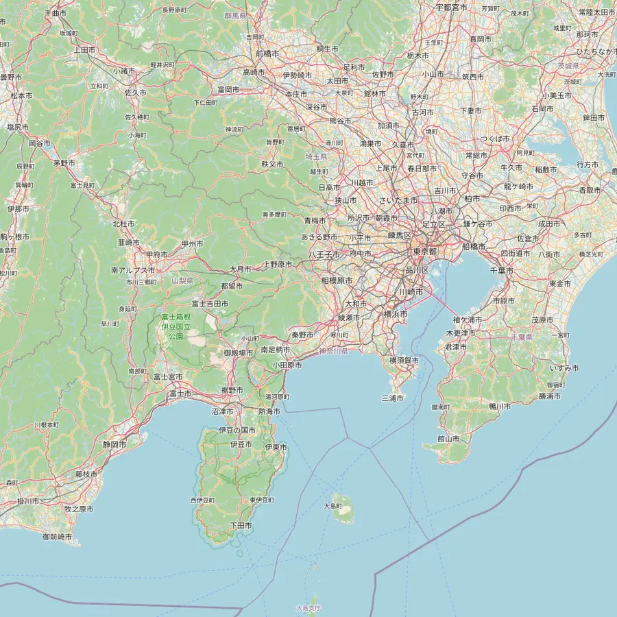 1Tokyo Station2Shinjuku3Kengamine summit4Kawaguchiko Station5Owakudani6Great Buddha, Kamakura
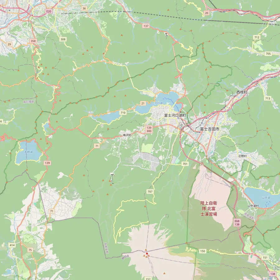 4Kawaguchiko Station7Oshino Hakkai8Lake Yamanaka swan shore9Chureito Pagoda10Oishi Park11Lake Sai12Lake Shoji13Lake Motosu
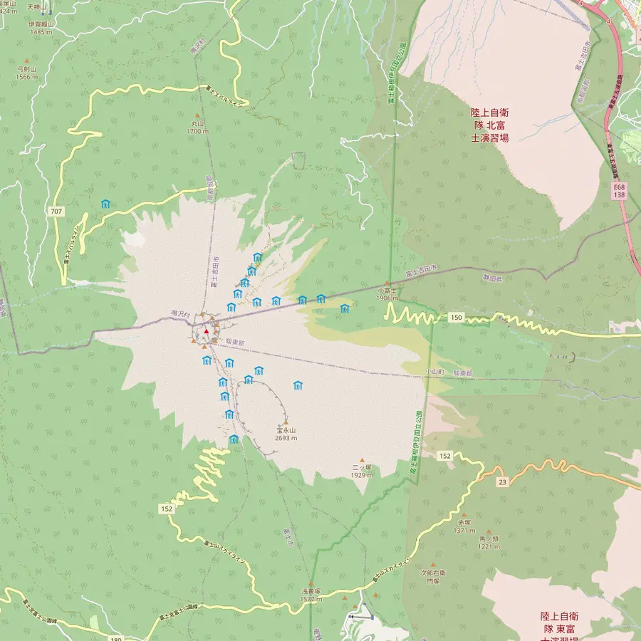 3Kengamine summit14Subaru Line 5th Station15Fujinomiya trailhead16Subashiri 5th Station17Gotemba New 5th Station18Hoei crater
- 1Tokyo Station
Meeting point of the site tour at 8:00 AM, about 101 km in a straight line from the summit.7
In Google Maps ↗ - 2Shinjuku
Second meeting point at 8:30 AM; the free 45th-floor observatories of the Tokyo Metropolitan Government stand here.2
In Google Maps ↗ - 3Kengamine summit
The highest point of Mount Fuji, 3,776 m, on the crater rim.23
In Google Maps ↗ - 4Kawaguchiko Station
End of the Fujikyu line, 26.6 km from Otsuki; buses from Shinjuku get here in just under two hours.2425
In Google Maps ↗ - 5Owakudani
A 50-minute guided stop of the site tour, reached on the Hakone Ropeway.
In Google Maps ↗ - 6Great Buddha, Kamakura
A bronze Buddha some 11.3 m tall, begun in 1252, about 74 km east of the summit.262728
In Google Maps ↗ - 7Oshino Hakkai
Eight spring ponds, a national natural monument since 1934 and part of the World Heritage site.29
In Google Maps ↗ - 8Lake Yamanaka swan shore
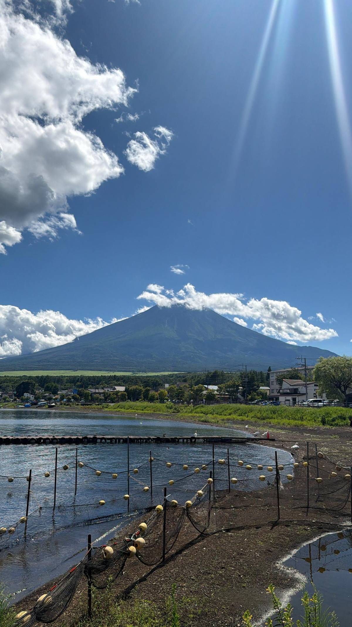
Lake Yamanaka is the nearest lake to Fuji; the site tour stops 20 minutes at its swan shore.30
In Google Maps ↗ - 9Chureito Pagoda
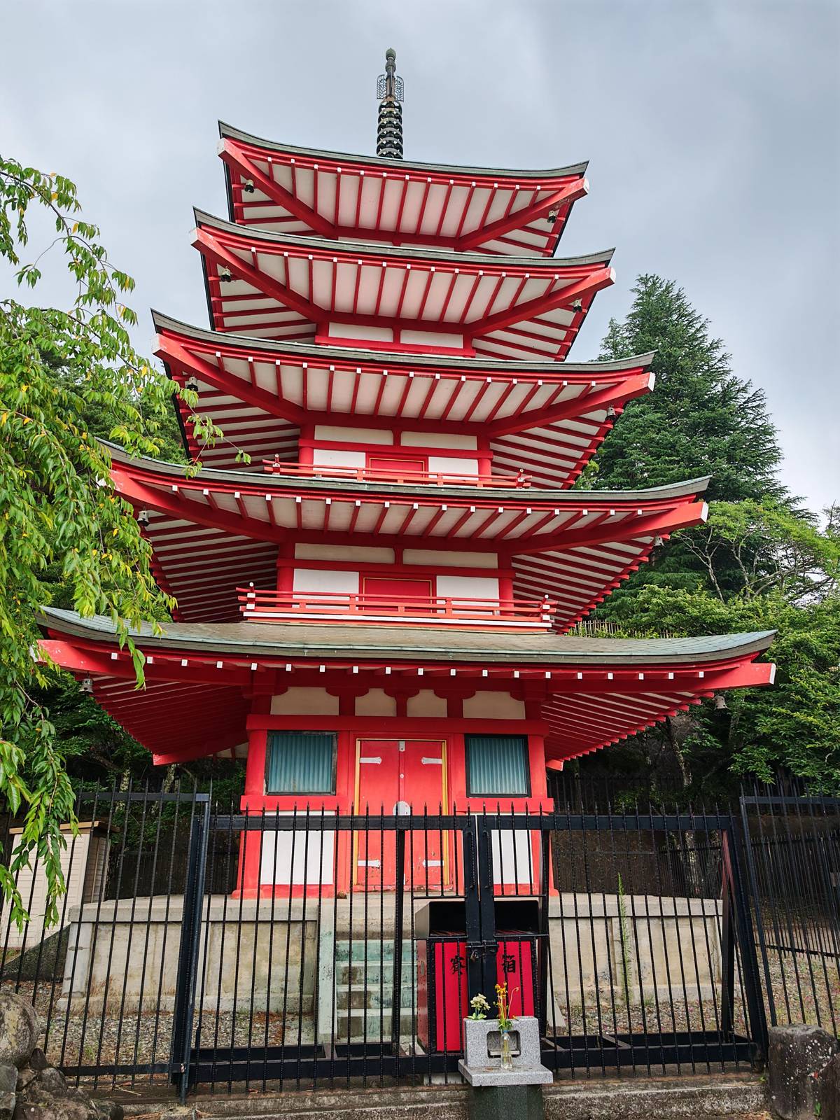
Up 398 steps in Arakurayama Sengen Park, about 25 minutes on foot from Shimoyoshida Station.3132
In Google Maps ↗ - 10Oishi Park
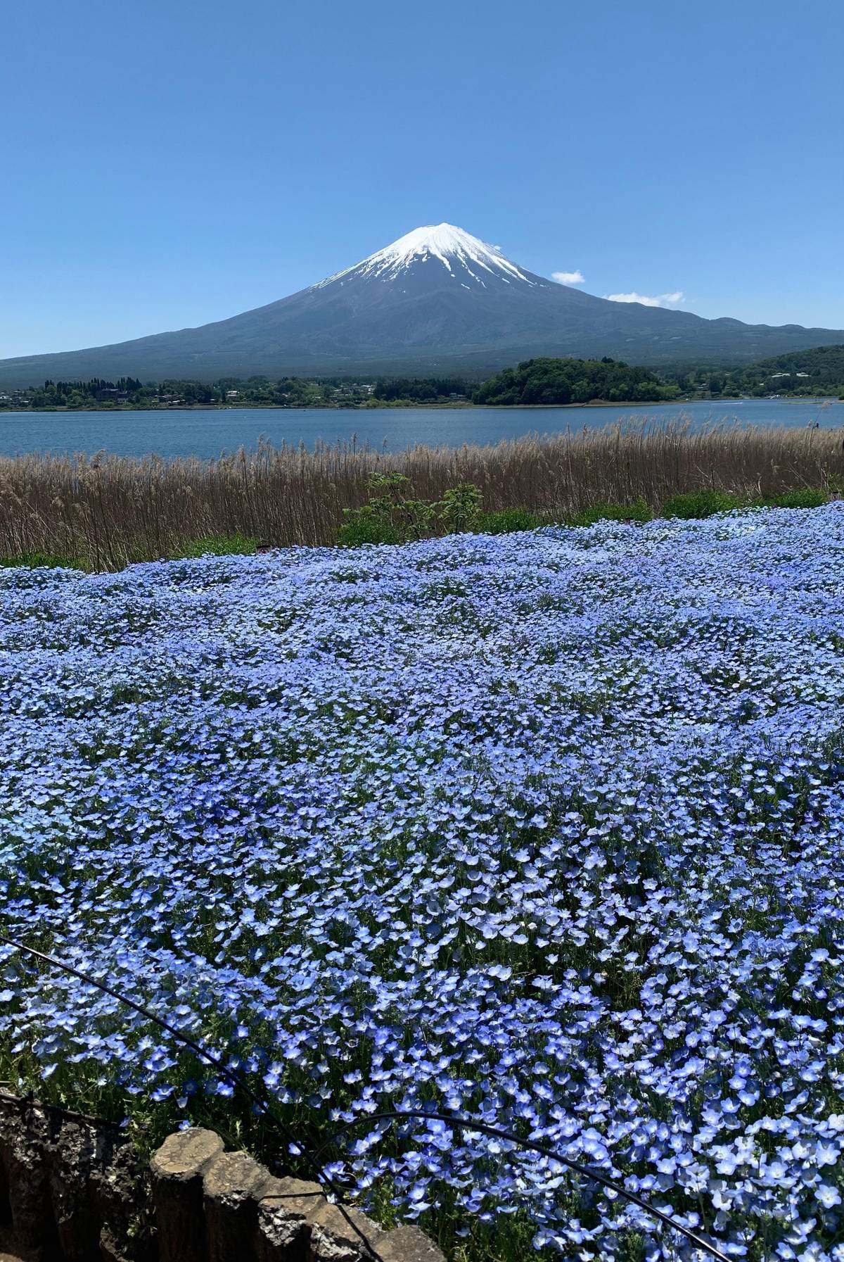
A Lake Kawaguchi park where Fuji rises behind lavender in early summer.33
In Google Maps ↗ - 11Lake Sai
Split off an older lake by the lava of the Jogan eruption of 864.34
In Google Maps ↗ - 12Lake Shoji
The smallest of the Fuji Five Lakes, known for its Upside-down Fuji reflection.3536
In Google Maps ↗ - 13Lake Motosu
The deepest of the five lakes and the view on the 1,000-yen note.3738
In Google Maps ↗ - 14Subaru Line 5th Station
Start of the Yoshida Trail at 2,305 m, with the climbers' gate and Komitake Shrine.394041
In Google Maps ↗ - 15
- 16Subashiri 5th Station
Trailhead at 2,000 m; in 2026 the Subashiri Trail opened on 1 July.4445
In Google Maps ↗ - 17Gotemba New 5th Station
Trailhead at 1,440 m; the way up is 10.5 km, about 9 hours.46
In Google Maps ↗ - 18Hoei crater
The southeast-flank crater of the eruption that began on 16 December 1707.47
In Google Maps ↗
Checklist
For a Fuji view from the city
Timing
- The first clear morning of your stay
- Winter rather than June or July
- Early, before haze builds
Where
- A west-facing window
- A right-side seat on the bullet train
- A day at the lakes if the city stays grey
Cost calculator
Price a day closer to the mountain
Enter your group size to compare days at the foot of Fuji.
Total from$107
per participant from $54
Check availabilityfree cancellationTotals here are a quick sum: the listing's GetYourGuide from-price times your party size, turned into your currency at the ECB rate for today. The final amount appears only at checkout.
Video
Mt. Fuji travel guide: when to go, where to see, how to plan
The video loads only when you tap play.
Diamond Fuji from a Tokyo tower
Twice a year, from places where Fuji stands due east or west of you, the sun sets or rises exactly on the summit and lights it like a jewel: the Diamond Fuji.21 Seen from Tokyo, the sun sets behind it, and the season for Diamond Fuji in general runs from late October to late February.48
Tokyo Skytree publishes its own dates. For 2026 it announced the best viewing time from its Tembo Deck and Tembo Galleria as around 17:00 on 3 February.22 The tower warns that the view depends on the weather and on how crowded the deck is.22
If you are in Tokyo on one of those dates, arrive early, pick a west-facing window and accept that clouds on the horizon can spoil the moment. It is one of the most beautiful sights the city offers, and one of the least reliable.
The view from the bullet train
The best Mount Fuji view from the shinkansen comes on the line between Tokyo and Kansai, where the train runs past the south side of the mountain. Japan's tourism organization advises sitting on the right side when leaving Tokyo and on the left side coming from Kansai.6
Book a window seat on the correct side when you reserve, and keep your camera ready after the train leaves the Tokyo suburbs. The view lasts only a short while at full speed, and clouds that sit on the summit in the afternoon can hide it from the line just as they do from the city.
A train window will not replace a day at the foot of the mountain, but it is a good way to see the whole cone at once, which a stop at the lakes sometimes cannot do when the lower slopes are wrapped in mist. Reserve the seat early if the view matters to you, and wipe the window at the last station before the mountain comes into sight.
Which months give you the best chance
Japan's tourism organization is clear about the seasons: from afar, crisp, clear winter days give the best viewing conditions, and the mountain is often hidden by clouds in the rainy season from early June to mid-July.45 Up close, early morning and late afternoon are best.49
The weather records near the mountain tell the same story. At Lake Kawaguchi, January averages 212.3 sunny hours on the Japan Meteorological Agency's normals, while June manages 122.8 and September 122.5.91213 Those figures describe the lakes, not Tokyo, but cloud over the mountain is what blocks the view from the city too.
If you visit in summer, do not give up: clear mornings happen, especially after a front has passed. Check the sky at dawn, and if the horizon is sharp, go to a high window before the morning haze builds. Live cameras around the lakes are another quick check: if they show the summit, the view from the city is worth trying the same morning.
When Tokyo shows nothing, go closer
If the city stays grey, the surest way to see Fuji is to go to its foot. At the lakes you stand right under the mountain instead of a whole city away, and even when the summit is in cloud, the lower slopes and the water have their own appeal.
A cheaper halfway option is Mt Takao, about 50 minutes from Shinjuku by train; Fuji views there need a climb, about two hours on foot from the top of the ropeway.19 The reward is a nearer horizon with the mountain clear of the city haze, plus a forest walk on a well-marked mountain path close to the city.
For the full day, a coach tour takes you to Hakone, Lake Yamanaka and Oshino Hakkai and back in 10 hours from $54. Its operator states plainly that visibility depends on the weather, which is true from any viewpoint.
Your day at Fuji
Hakone, Lake Yamanaka and Oshino in one day.
Meet at Tokyo Station or Shinjuku, pick a date, and cancel free up to 24 hours before.


You ask,we answer.
Can you see Fuji from Tokyo every day?
No, only on clear days. Haze and cloud often hide it. Crisp, clear winter days give the best odds, and early morning is usually better than the afternoon.4
Where is the best free view?
The city hall decks in Shinjuku. Two observatories on the 45th floor, 202 m up, free of charge.2
How far away is the mountain?
About 101 km from Tokyo Station. That is the straight line; from the Shinjuku city hall it is about 95 km.78
Can you see Fuji from Skytree?
Yes, on clear days. Its Tembo Deck on floor 350 advertises the view of the mountain on clear days.3
Which side of the bullet train?
The right side from Tokyo. Leaving Tokyo sit on the right; travelling from Kansai, sit on the left side.6
When is Diamond Fuji?
Late October to late February. Tokyo Skytree gave about 17:00 on 3 February 2026 as its best viewing time.4822
What if it is cloudy?
Go closer. A day at the lakes puts you right under the mountain; visibility is never guaranteed.
Sources
What this text is based on
- 1Japan National Tourism Organization (JNTO)Fujisan: Sacred Place and Source of Artistic Inspiration (UNESCO)↩
- 2Japan National Tourism Organization (JNTO)The Top 30 Spots for Viewing Mt. Fuji↩
- 3TOKYO SKYTREE (Tobu Tower Skytree)TOKYO SKYTREE official website↩
- 4Japan National Tourism Organization (JNTO)The Top 30 Spots for Viewing Mt. Fuji↩
- 5Japan National Tourism Organization (JNTO)The Top 30 Spots for Viewing Mt. Fuji↩
- 6Japan National Tourism Organization (JNTO)The Top 30 Spots for Viewing Mt. Fuji↩
- 7Geospatial Information Authority of JapanGeodesic distance calculation: Fujisan summit (Kengamine) to Tokyo Station↩
- 8Geospatial Information Authority of JapanGeodesic distance calculation: Fujisan summit (Kengamine) to the Tokyo Metropolitan Government Building↩
- 9Japan Meteorological AgencyClimate normals 1991-2020: Kawaguchiko (heinenchi)↩
- 10Japan Meteorological AgencyClimate normals 1991-2020: Kawaguchiko (heinenchi)↩
- 11Japan Meteorological AgencyClimate normals 1991-2020: Kawaguchiko (heinenchi)↩
- 12Japan Meteorological AgencyClimate normals 1991-2020: Kawaguchiko (heinenchi)↩
- 13Japan Meteorological AgencyClimate normals 1991-2020: Kawaguchiko (heinenchi)↩
- 14Japan Meteorological AgencyClimate normals 1991-2020: Kawaguchiko (heinenchi)↩
- 15Japan Meteorological AgencyClimate normals 1991-2020: Kawaguchiko (heinenchi)↩
- 16Japan National Tourism Organization (JNTO)The Top 30 Spots for Viewing Mt. Fuji↩
- 17Japan National Tourism Organization (JNTO)The Top 30 Spots for Viewing Mt. Fuji↩
- 18Japan National Tourism Organization (JNTO)The Top 30 Spots for Viewing Mt. Fuji↩
- 19Japan National Tourism Organization (JNTO)The Top 30 Spots for Viewing Mt. Fuji↩
- 20Geospatial Information Authority of JapanGeodesic distance calculation: Fujisan summit (Kengamine) to Tokyo Skytree↩
- 21TOKYO SKYTREE (Tobu Tower Skytree)Let's watch Diamond Fuji from TOKYO SKYTREE!↩
- 22TOKYO SKYTREE (Tobu Tower Skytree)Let's watch Diamond Fuji from TOKYO SKYTREE!↩
- 23Japan Meteorological AgencyNational Catalogue of the Active Volcanoes in Japan: 55. Fujisan↩
- 24Fujikyu Railway (Fujisanroku Electric Railway)Fujikyu Railway Line (top page)↩
- 25Japan National Tourism Organization (JNTO)Fuji Five Lakes Area↩
- 26↩
- 27↩
- 28Geospatial Information Authority of JapanGeodesic distance calculation: Fujisan summit (Kengamine) to the Great Buddha of Kamakura↩
- 29Yamanashi Tourism Organization (official tourism site of Yamanashi Prefecture)忍野八海 (Oshino Hakkai)↩
- 30Japan National Tourism Organization (JNTO)The Top 30 Spots for Viewing Mt. Fuji↩
- 31Fujiyoshida Tourism Promotion Service (official Fujiyoshida tourist guide)Arakurayama Sengen Park and Chureito Pagoda↩
- 32Fujiyoshida Tourism Promotion Service (official Fujiyoshida tourist guide)Arakurayama Sengen Park and Chureito Pagoda↩
- 33Japan National Tourism Organization (JNTO)The Top 30 Spots for Viewing Mt. Fuji↩
- 34Japan Meteorological AgencyNational Catalogue of the Active Volcanoes in Japan: 55. Fujisan↩
- 35Japan National Tourism Organization (JNTO)The Top 30 Spots for Viewing Mt. Fuji↩
- 36Japan National Tourism Organization (JNTO)Fuji Five Lakes Area↩
- 37Japan National Tourism Organization (JNTO)Fuji Five Lakes Area↩
- 38Japan National Tourism Organization (JNTO)The Top 30 Spots for Viewing Mt. Fuji↩
- 39Council for the Promotion of Appropriate Use of Mt. Fuji (official Mt. Fuji climbing website: Ministry of the Environment, Yamanashi and Shizuoka Prefectures)Comparison of Routes↩
- 40Council for the Promotion of Appropriate Use of Mt. Fuji (official Mt. Fuji climbing website: Ministry of the Environment, Yamanashi and Shizuoka Prefectures)FAQ↩
- 41Fujiyoshida Tourism Promotion Service (official Fujiyoshida tourist guide)Fuji Subaru Line 5th Station↩
- 42Council for the Promotion of Appropriate Use of Mt. Fuji (official Mt. Fuji climbing website: Ministry of the Environment, Yamanashi and Shizuoka Prefectures)Comparison of Routes↩
- 43Council for the Promotion of Appropriate Use of Mt. Fuji (official Mt. Fuji climbing website: Ministry of the Environment, Yamanashi and Shizuoka Prefectures)Comparison of Routes↩
- 44Council for the Promotion of Appropriate Use of Mt. Fuji (official Mt. Fuji climbing website: Ministry of the Environment, Yamanashi and Shizuoka Prefectures)Comparison of Routes↩
- 45Council for the Promotion of Appropriate Use of Mt. Fuji (official Mt. Fuji climbing website: Ministry of the Environment, Yamanashi and Shizuoka Prefectures)[Shizuoka Prefecture Route] Restrictions on climbing Mt. Fuji (2026)↩
- 46Council for the Promotion of Appropriate Use of Mt. Fuji (official Mt. Fuji climbing website: Ministry of the Environment, Yamanashi and Shizuoka Prefectures)Comparison of Routes↩
- 47Japan Meteorological AgencyNational Catalogue of the Active Volcanoes in Japan: 55. Fujisan↩
- 48Japan National Tourism Organization (JNTO)The Top 30 Spots for Viewing Mt. Fuji↩
- 49Japan National Tourism Organization (JNTO)The Top 30 Spots for Viewing Mt. Fuji↩